|
Photos are courtesy of the Shutesbury Historical Commission and are available as postcards (printable order form). Click on photos for a description and larger view. |
In 1874, Elias Nason described the town of Shutesbury as follows:
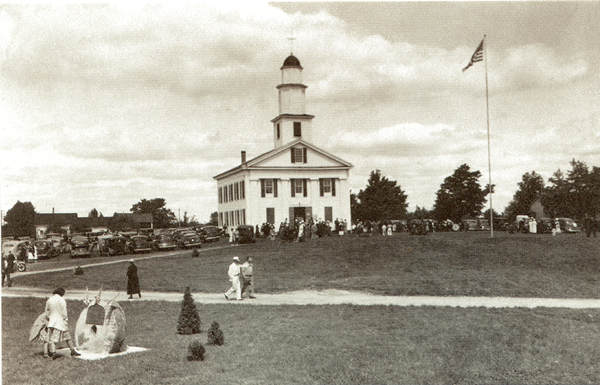 Town Celebration, 1937 Click to see larger photo. |
Shutesbury occupies the south-east corner of Franklin County, is 112 miles west of Boston, and has New Salem and Prescott (from the latter of which it is divided by Swift River) on the east, Pelham on the south, Amherst and Leverett on the west, and the latter and Wendell on the north. It has 614 people, 154 dwelling-houses, 150 farms, and a valuation of $194,865. It was settled by families from Sudbury; for some time bore the name of "Roads Town," but received at its incorporation (June 30, 1764) its present name in honor of Gov. Samuel Shute. The land is rocky and uneven. The highest eminence is Morse's Hill, which overlooks Lock's Pond and Lock's Village in the north-west angle of the town. Near this place molybdenite, a sulphuret of molybdenum, is found. An immense bowlder east of Lock's Pond, called "The Sentinel," bears the marks of telluric forces, and was doubtless brought from a long distance during the glacial period. It may be considered as one of the earliest settlers of the town. Swift River drains the eastern, Roaring Brook and other streams the western section of the town. Near the centre of the town there is a mineral spring, impregnated with muriate of lime, which has obtained celebrity.
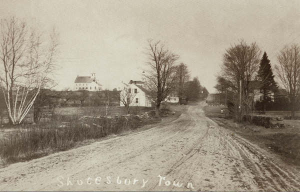 Leverett Road, 1900 Click to see larger photo. |
Mount Mineral Spring was incorporated in 1867. There is much woodland in the place; and eight or ten saw-mills are constantly preparing lumber, laths, clapboards, shingles, and staves for market. Many railroad-ties are cut here; and as many as 59,000 bushels of charcoal have been made in a year. The town has one post-office; seven district-schools; a Congregational church (established Oct. 27, 1842), of which the Rev. John P. Watson is pastor; and a Baptist church of which the Rev. J. D. Donovan is pastor.
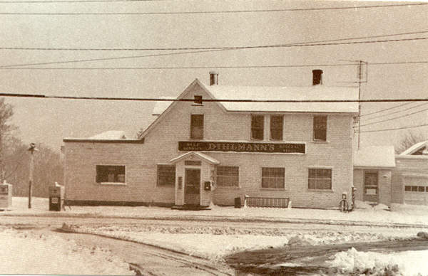 Dihlman Store, 1968 Click to see larger photo. |
The town sent 18 soldiers into the late war, of whom 3 were lost. The salubrity of the air is highly conducive to the longevity of the people.
Ephraim Pratt, a resident of this place, was born in Sudbury Nov. 1, 1687; and died here in May, 1804, at the remarkable age of 116 years. He married Martha Wheelock at the age of 21; and lived to see, it is said, 1,500 descendants. He was temperate and cheerful.
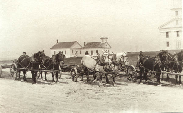 Town Common, 1880 Click photo to see larger version. |
The Hon. PAUL DILLINGHAM was born here in August, 1800; and in 1805 removed with his father to Waterbury, Vt., of which State he was, from 1865 to 1867, governor. S. H. Crandall is the present town-clerk.
(Source: Nason, Elias, 1811-1887. A gazetteer of the state of Massachusetts: with numerous illustrations on wood and steel / by Elias Nason. Boston: B.B. Russell, 1874. p. 464)
The Town of Shutesbury has carried some of its past history forward. Once known as a lumbering town, Shutesbury still retains some lumbering interests. Named for Governor Samuel Shute, the town was established in 1761 and its plentiful mineral springs resulted in a healthy bottling business growing up in the community. Shutesbury is bordered by the Quabbin Reservoir, and the town's proximity to the huge body of water ensures preservation of some of its rural character because of the restrictions placed on development within the watershed of the Quabbin.
Historical Information and Resources
Historical Commission home
Historical resources